Use the following to search across all the cemeteries listed.
Example: "Smith, Roger" (yes, use the quotes)
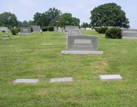
- 004 CHARITY CHURCH

Location - on Gum Bridge Rd at the intersection with Charity Neck Rd.
Coordinates: 36d 40m 21.8s N; 76d 00m 04.6s W Click here for Online Maps
- 002 COLONIAL GROVE MEMORIAL PARK
Location - at the intersection of Princess Anne Rd and Dam Neck Rd, Virginia Beach.
Coordinates: 36d 46m 26.9s N; 76d 05m 27.7s W Click here for Online Maps
- 003 PRINCESS ANNE MEMORIAL PARK
Location - on N. Great Neck Rd (Hwy 279) at Meadow Lake Rd, Virginia Beach.
Coordinates: 36d 52m 00.1s N; 76d 02m 25.3s W Click here for Online Maps
- 001 ROSEWOOD MEMORIAL PARK
Location - 631 N Witchduck Rd, Hwy 190, Virginia Beach.
Coordinates: 36d 51m 30.6s N; 76d 08m 54.8s W Click here for Online Maps
Web page updated 21 April 2021
|
|
 |