Index of All Cemeteries Alphabetical Index of All Burials Previous Page
Use the following to search across all the cemeteries listed.
Example: "Smith, Roger" (yes, use the quotes)
204 PAYNE'S CHAPEL BAPTIST CHURCH CEMETERY
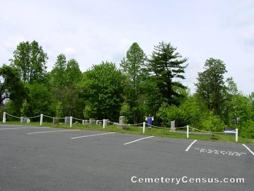
Location - 1164 Paynetown Rd, Mt. Airy, Surry Co., NC.
Coordinates: 36d 31m 06.0s N; 80d 33m 39.2s W Click here for Online Maps
Directions: From intersection of Renfro St and E. Pine St in Mt. Airy, go east on E. Pine St (NC Hwy 103) for 3.3 miles and turn left on Paynetown Rd. Then g .3 miles and the church and cemetery on the right.
View of the church.
Surveyed by Andy Hennis on April 6, 2006.
Township or district: Mt. Airy.
Public or Private: Public Access.
GPS Accuracy (ft.): 10.
Elevation above sea level (ft.): 1265.
336-786-4841.
Web page updated 15 April 2021
Index of All Cemeteries Alphabetical Index of All Burials Previous Page
|
|
 |
