Index of All Cemeteries Alphabetical Index of All Burials Previous Page
Use the following to search across all the cemeteries listed.
Example: "Smith, Roger" (yes, use the quotes)
502 ASHBURN FAMILY (Ararat Rd)

Location - off Ararat Rd and Bullard Lane, near the Ararat Fire Department; about 450 feet east of Bullard Rd.
Coordinates: 36d 24m 09.6s N; 80d 33m 19.0s W Click here for Online Maps
Directions: From intersection of US Hwy 52 and Cook School Rd just north of Pilot Mtn, go west on Cook School Rd and turn right on Old Hwy 52 north (at the yield sign). Then go 1.3 miles and turn left on Ararat Rd and follow it for 2.4 miles. Turn left onto unnamed gravel road between 1369 and 1389 Ararat Road. There is a padlocked chain across the road and the property should be treated as posted private property.
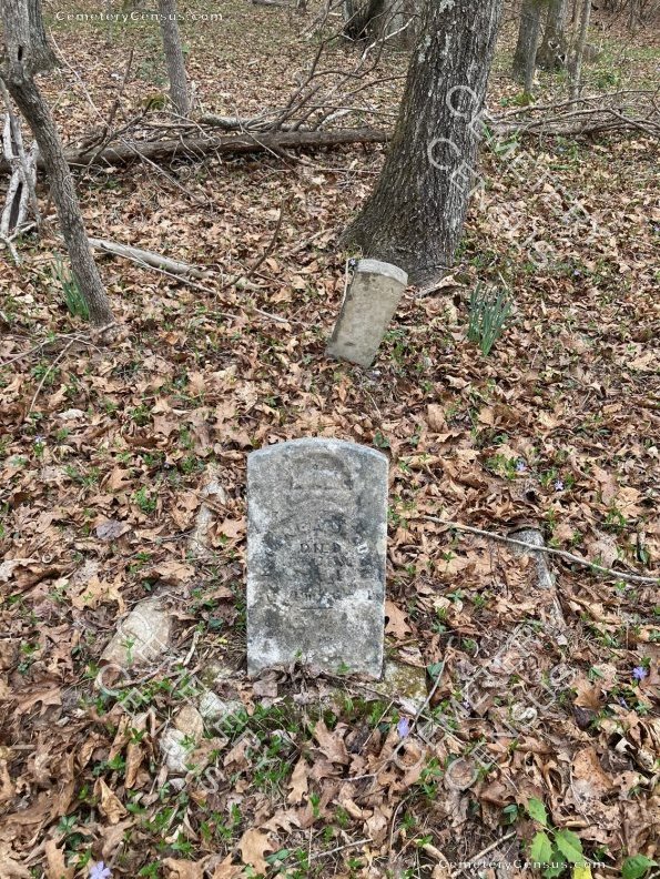
The cemetery is a plot about 15 feet by 15 feet. Unknown how many burials. Only one grave has an inscribed marker.
The land is being sold in 2021.
Photographs provided by the property owner Jonathan Cleveland who has only recently located the gravesite. Mr. Cleveland was most helpful. He indicated that as he began exploring the old abandoned homeplace, "several" shoes were found inside, more than would be considered normal. Based on his research (which the 1880 Census confirms) the head of family was Mr. Lindsy J. Ashburn who was a Shoemaker by profession.
Thanks also to a longterm local resident Bill Bryant for sharing his memories of the area.
Parcel ID: 5946-00-28-1747. Deed book 64 page 108.
Township: Pilot.
Public or private: Private property. Owner permission required.
Condition: Not maintained, overgrown and difficult to access.
GPS Accuracy (Ft.) 15.
Elevation: 1050 feet.
Reported by Jonathan Semones in March 2021.
Visited by David Hawkins in May 2021.
 Ashburn, Florence Jane (b. 21 Mar 1880 - d. 13 Aug 1886) Ashburn, Florence Jane (b. 21 Mar 1880 - d. 13 Aug 1886) Daughter of Lindsy J. Ashburn and Mary Jane Perkins Ashburn. "Lived 6Ys 4Ms 22Ds".
Web page updated 23 May 2021
Index of All Cemeteries Alphabetical Index of All Burials Previous Page
|
|
 |


